Tell es-Safi, Israel, Summer 2004
Tracking the Trench
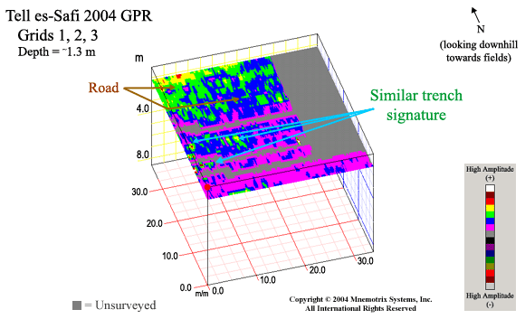
Grids 1, 2, 3:
Click for GPS Coordinates
These were the first grids acquired, in their numbered sequence.
Grid 1 was the first area chosen for accessibility
in the middle of a huge general area laid out by
Dr. Aren Maeir based on many years of experience
working at Tell es-Safi, and based on an educated
"best guess" as to where the trench should lead.
Transects were acquired in a somewhat coarse grid
(every 1-2 meters) so as to cover as much ground
as possible in a reasonable amount of time.
The raised berm area lies to the east (at right of
surveyed area).