Tell es-Safi, Israel, Summer 2004 - 2005
Tracking the Trench
GPR Whole Trench Study in a GIS Model Zoom Out to Tell es-Safi Site Map |
Conclusions and Ground Truth 2005
Zoom Out to Tell es-Safi Site Map |
Conclusions and Ground Truth 2005 
Zoom Out to Tell es-Safi Site Map |
Conclusions and Ground Truth 2005
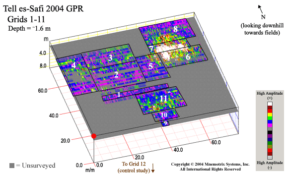
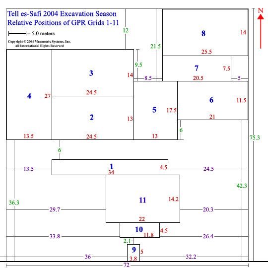
In what may be one of the largest contiguous geo-archaeological GPR studies done to date, this summer we went in search of the continuation of the siege trench around the city located at the ancient city of Gath, on the high Tell (hill) at es-Safi (which means "white cliffs"), which may have led to the ultimate destruction of that phase of civilization in the mid-8th century BCE (Iron IIB). An area of about 75 square meters was surveyed in 11 contiguous separately acquired grids of GPR transects. These were put together into a Super 3D grid which covers the side of the hill sloping down towards the current cultivated fields to the north.Click on each grid area below to see a closeup GPR signature which runs through the area. Animations of the full range of depth slices can also be seen for our control study, Grid 12, where the trench has been excavated in previous seasons, and for Grids 9, 10, and 11, which covered the next accessible area extending down the steepest portion of the slope. It is hoped that this signature can be mapped to the archaeological field study at the site and assist in planning the work to be done in future seasons.
GPS Coordinates & Elevations of GPR Survey Grids
Return to GPR Trench Study Introduction